A Research Toolkit for Building the Ultimate Urban Forest

Who will you meet?
Cities are innovating, companies are pivoting, and start-ups are growing. Like you, every urban practitioner has a remarkable story of insight and challenge from the past year.
Meet these peers and discuss the future of cities in the new Meeting of the Minds Executive Cohort Program. Replace boring virtual summits with facilitated, online, small-group discussions where you can make real connections with extraordinary, like-minded people.
Whether you live in a town with a single main street or a megacity, the trees and green space in your larger neighborhood are key to the economic, human and environmental health of you and your community. The presence, or absence, of a thriving urban forest has a direct impact on our individual and collective quality of life in more ways that most people ever realize.
In order to ensure our urban trees are doing the most for us, we need to know what we’ve got. Next comes an evaluation of what is needed and how to get there. And underscoring all of that is why this investment is so important and how it pays us back.
Why It’s So Important to Invest in our Urban Forest
A community’s green infrastructure — trees, vegetation and water — is just as important as its roads, pipes and power lines. Decades of research on small towns to dense megacities, show that our urban forests deliver measurable economic benefits, reduce strain on built infrastructure and improve people’s health and quality of life on many different fronts.
Vibrant Cities Lab: A newly-launched website by the U.S. Forest Service, American Forests and the National Association of Regional Councils, merges the latest research with best practices for implementing green infrastructure projects in your community.
Where do we find this research supporting urban forests? The Vibrant Cities Lab is a new one-stop shop for the latest research on green infrastructure. Conveniently and smartly packaged in one website, Vibrant Cities Lab showcases topic-by-topic information and research on how trees have a positive impact on public health (from asthma reduction rates to lowering domestic crime), economics, improving water quality, and social justice issues. Trees are the key to connecting to a better quality of life in our neighborhoods. There are dozens of user-friendly case studies and even a step-by-step guide on how to move forward on your own urban forest efforts.
Unpacking your Urban Forestry Starter Kit
Don’t need convincing that healthy urban canopy and green space improves the quality of residents’ lives? Maybe you or your municipality are ready to embrace a healthier town or city, but aren’t sure which tools your community forest needs or what options are on the table. This is where the starter kit comes in. The USDA Forest Service has collaboratively developed a suite of tools to assess and measure the current state of a community’s forest, and to inform plans to maintain and strengthen that urban forest.
All of these tools, whether used together or separately help communities understand the make-up, condition and value (social, economic and environmental) of their unique urban forest. The data collected and analyzed from these cutting-edge tools also provide compelling backstories and economic incentives for smart policy making and budget justifications.
The tools and technologies described below can be used individually or in conjunction to collect key information about urban data that are vital to any sustainable and practical urban forestry and resiliency plan – for communities of all sizes. Trees and green space management is complex and crosses many boundaries: regulatory, social and economic. Selecting the right combination of tools allows anyone to customize their starter pack.
- iTree
- Urban FIA
- STEW-MAP
- Urban Tree Canopy
- FLAT
- On-line Adaptation Workbook
i-Tree
i-Tree is a free software suite that provides communities with forest analysis and tools. i-Tree can help users understand the local, tangible ecosystem services that trees provide, linking forest management activities with environmental quality and community livability. It provides baseline data that can be used to set priorities for more effective decision-making (from school boards to county council budget committees). i-Tree software can estimate the benefits of the tree in your backyard or of the trees in an entire watershed area. Its versatility and user-friendly design make it applicable to provide key information on Capitol Hill or to third-grade classrooms.
Urban FIA
Urban Forestry Inventory and Analysis (Urban FIA) is an extension of the traditional FIA program, and inventories and monitors urban forests, on both public and private land across the nation, with a special emphasis on America’s largest cities. It collects data on the values, land ownership objectives, and forest management practices of provide forest landowners. It even includes a pilot effort to understand urban wood flows to help support and grow the US wood industry. This data can illuminate regional or national trends in urban forest health and status.
Stewardship Mapping & Assessment Project
The Stewardship Mapping & Assessment Project (STEW-MAP) was developed by researchers at the Northern Research Station in NYC out of a recognition that taking stock of social infrastructure is just as important as knowing about a city’s biophysical infrastructure. In addition, public agencies face complex challenges and limited budgets; effective solutions may require productively involving and leveraging community capacity. The STEW-MAP tool enables users to study the social landscape of environmental stewardship activities to understand which groups or organizations are active and what kind of work they are doing across the urban landscape. By mapping this out, a user can get a sense of resources and gaps, and may be able to engage groups and partner organizations to help address a project need, be it a local stream clean-up or a comprehensive urban forest plan or canopy conservation project.
Urban land managers are increasingly using STEW-MAP to discover and leverage civic capacity. It has been implemented in U.S. cities from New York to Los Angeles and overseas in places such as Colombia, France, and the Dominican Republic. The basis of the program is a survey that helps to identify and evaluate traditional and non-traditional stewardship groups such as block associations, conservation and recreation clubs, tree-planting groups, nonprofit educational institutions and museums, and more.
Urban Tree Canopy
The Urban Tree Canopy (UTC) suite of tools consists of high-resolution mapping methodology that integrates green and gray land cover data with critical social, economic, and environmental information to inform sustainability and resilience policy, planning, and management. UTC allows for the integration of high resolution green infrastructure data with parcel-level data; this can inform a wide variety of questions and outcomes linked to improving quality of life – ranging from safety and crime to public health and water quality. UTC is now used in dozens of cities, and has been used to create and inform tree planting and other goals that improve quality of life for millions of people.
Forest Landscape Assessment Tool
The Forest Landscape Assessment Tool (FLAT) is a set of procedures and tools used to rapidly determine forest ecological conditions and potential threats. FLAT enables planners and managers to understand baseline conditions, determine and prioritize restoration needs across a landscape system, and conduct ongoing monitoring to achieve land management goals. The rapid assessment process presents a cost-effective opportunity for landowners that include local governments, private owners, and nongovernmental organizations to use ecological data to guide decision-making and improve environmental outcomes on their lands.
Climate Change Adaptation Workbook
The Climate Change Adaptation Workbook is specifically tailored to address climate change and community resiliency. The Workbook has a dedicated section evaluating forests in the urban environment. It provides a structured process to consider the potential effects of climate change and design land management and conservation actions that can help prepare for changing conditions. The process is flexible to accommodate a wide variety of geographic locations, ownership types, ecosystems and land uses, management goals, and project sizes. For example, does your community need to re-evaluate tree species that are more flood or drought tolerant?
According to Lindsay Campbell, a research social scientist for the Northern Research Station in New York City, “When it comes to land management, there are multiple complimentary approaches needed in order to be effective at different times, on different sites, and in different communities. Sometimes you need to dig in the dirt and sometimes it’s all about organizing coalitions.”
As communities and municipalities around America are grappling with extreme weather events, it is even more vital to incorporate smart urban tree canopy and green infrastructure planning into all resiliency and climate change planning. Assessing your community’s current green infrastructure assets and deficits provides immediate information for maximizing your quality of living but also sets out the road map for how prepared your community may be for extreme weather events – from flooding to hurricanes to drought. Take advantage of the Vibrant Cities Lab site and any of the tools in this urban forestry “starter pack” or wade in by reaching out to the experts at the USDA Forest Service. They can connect and steer you to local or regional resources familiar with these tools.
For more information about these programs or urban forest research, contact Phillip Rodbell, National Program Manager for Urban Forestry Research prodbell@fs.fed.us or Lauren Marshall, National Program Manager for Urban & Community Forestry, lemarshall@fs.fed.us.
Discussion
Leave your comment below, or reply to others.
Please note that this comment section is for thoughtful, on-topic discussions. Admin approval is required for all comments. Your comment may be edited if it contains grammatical errors. Low effort, self-promotional, or impolite comments will be deleted.
1 Comment
Submit a Comment
Read more from MeetingoftheMinds.org
Spotlighting innovations in urban sustainability and connected technology
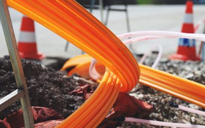
Middle-Mile Networks: The Middleman of Internet Connectivity
The development of public, open-access middle mile infrastructure can expand internet networks closer to unserved and underserved communities while offering equal opportunity for ISPs to link cost effectively to last mile infrastructure. This strategy would connect more Americans to high-speed internet while also driving down prices by increasing competition among local ISPs.
In addition to potentially helping narrow the digital divide, middle mile infrastructure would also provide backup options for networks if one connection pathway fails, and it would help support regional economic development by connecting businesses.
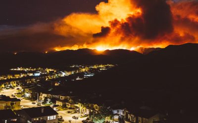
Wildfire Risk Reduction: Connecting the Dots
One of the most visceral manifestations of the combined problems of urbanization and climate change are the enormous wildfires that engulf areas of the American West. Fire behavior itself is now changing. Over 120 years of well-intentioned fire suppression have created huge reserves of fuel which, when combined with warmer temperatures and drought-dried landscapes, create unstoppable fires that spread with extreme speed, jump fire-breaks, level entire towns, take lives and destroy hundreds of thousands of acres, even in landscapes that are conditioned to employ fire as part of their reproductive cycle.
ARISE-US recently held a very successful symposium, “Wildfire Risk Reduction – Connecting the Dots” for wildfire stakeholders – insurers, US Forest Service, engineers, fire awareness NGOs and others – to discuss the issues and their possible solutions. This article sets out some of the major points to emerge.
Innovating Our Way Out of Crisis
Whether deep freezes in Texas, wildfires in California, hurricanes along the Gulf Coast, or any other calamity, our innovations today will build the reliable, resilient, equitable, and prosperous grid tomorrow. Innovation, in short, combines the dream of what’s possible with the pragmatism of what’s practical. That’s the big-idea, hard-reality approach that helped transform Texas into the world’s energy powerhouse — from oil and gas to zero-emissions wind, sun, and, soon, geothermal.
It’s time to make the production and consumption of energy faster, smarter, cleaner, more resilient, and more efficient. Business leaders, political leaders, the energy sector, and savvy citizens have the power to put investment and practices in place that support a robust energy innovation ecosystem. So, saddle up.


I am wiring an FAO online booklet. Could I use the photo at the top of this web page https://meetingoftheminds.mystagingwebsite.com/a-research-toolkit-for-building-the-ultimate-urban-forest-29208? If so, how do I credit the photo?